
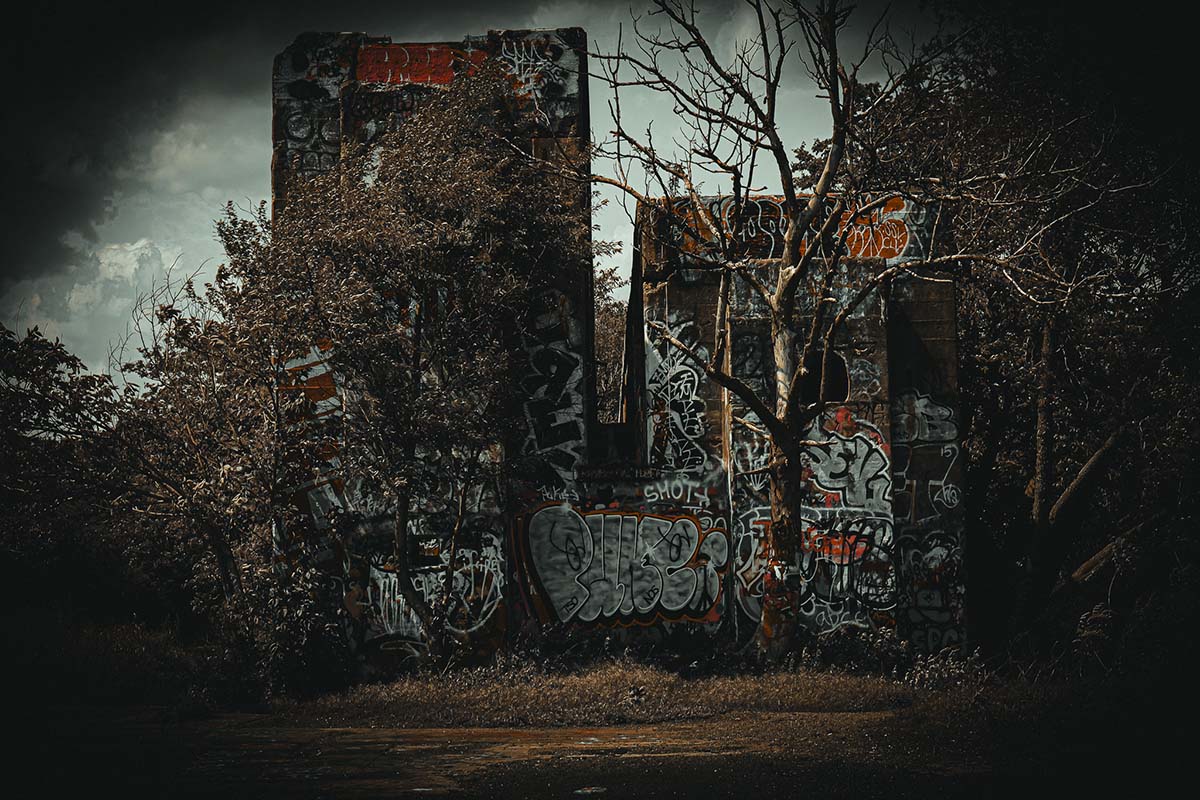
Graffiti Pier is Pier 18 on Philadelphia’s Port Richmond waterfront, an industrial structure transformed by artists into a constantly changing outdoor gallery. It is culturally important, but it is not yet a finished public park or a conventional visitor attraction. The Delaware River Waterfront Corporation still lists the project in planning and concept, says property acquisition remains under negotiation, and plans structural work before safe public access. After a partial collapse in 2024, the responsible choice is to avoid presenting an informal route as permission and use established public riverfront spaces for a visit today.
Graffiti Pier quick facts
- Place
- Pier 18 on the Delaware River in Port Richmond
- Project lead
- Delaware River Waterfront Corporation
- Current project status
- Planning and concept; estimated completion date to be determined
- Ownership
- DRWC says acquisition negotiations with Conrail continue
- Primary limitation
- No finished public-park access and documented structural damage
- Facts checked
- July 28, 2026
Why does Graffiti Pier matter?
The pier brings together Philadelphia’s working waterfront, freight history, spontaneous vegetation, and an open-ended street-art practice. Paint is not a decorative layer added to a completed attraction; it is the reason the place developed a public identity. The official Graffiti Pier Park project page describes a six-acre transfer concept and a planning process built around continuing artistic production, retaining passive vegetation, improving safety, and preserving the site’s grit.
That future deserves accurate language now. Calling the pier a “hidden gem” erases the artists and neighbors who made it visible, while calling it open suggests amenities and structural protections that do not yet exist. A better article follows the project, documents the creative landscape, and separates public interest from present access.
Can you visit Graffiti Pier now?
The available official record does not support publishing a routine walking route into the site. DRWC says the first phase will address structural damage, guardrails, high-risk areas, trails, art walls, and site furniture after acquisition and design work. Its August 2024 statement responds to a partial collapse. Together, those facts make “check a social post and go” an inadequate access standard.
Do not cross fencing, active rail property, work areas, or private land. Do not launch a drone or stage a shoot based on the popularity of images made by others. Recheck the official project page for a formal opening, public event, or announced access route. Until then, photograph the riverfront from places that are designed and maintained for public use.
Where can you get a legal riverfront experience?
Riverfront North Partnership’s official walk-and-bike guide connects public parks and trails along the Northeast Philadelphia waterfront. Use it to choose an established segment with marked access rather than improvising around Pier 18. Closer to the central waterfront, public spaces such as Penn Treaty Park and the Delaware River Trail provide river, bridge, industry, and changing light without asking visitors to interpret a fence line.
For city wildlife and open-water views, use the John Heinz National Wildlife Refuge guide. For a forested urban walk, the Wissahickon Valley guide provides a completely different Philadelphia landscape. The Schuylkill River Trail guide is the better fit when first light and skyline reflections are the priority.